Designated Marine Parks and Marine Reserve
Southwest Lantau Marine Park
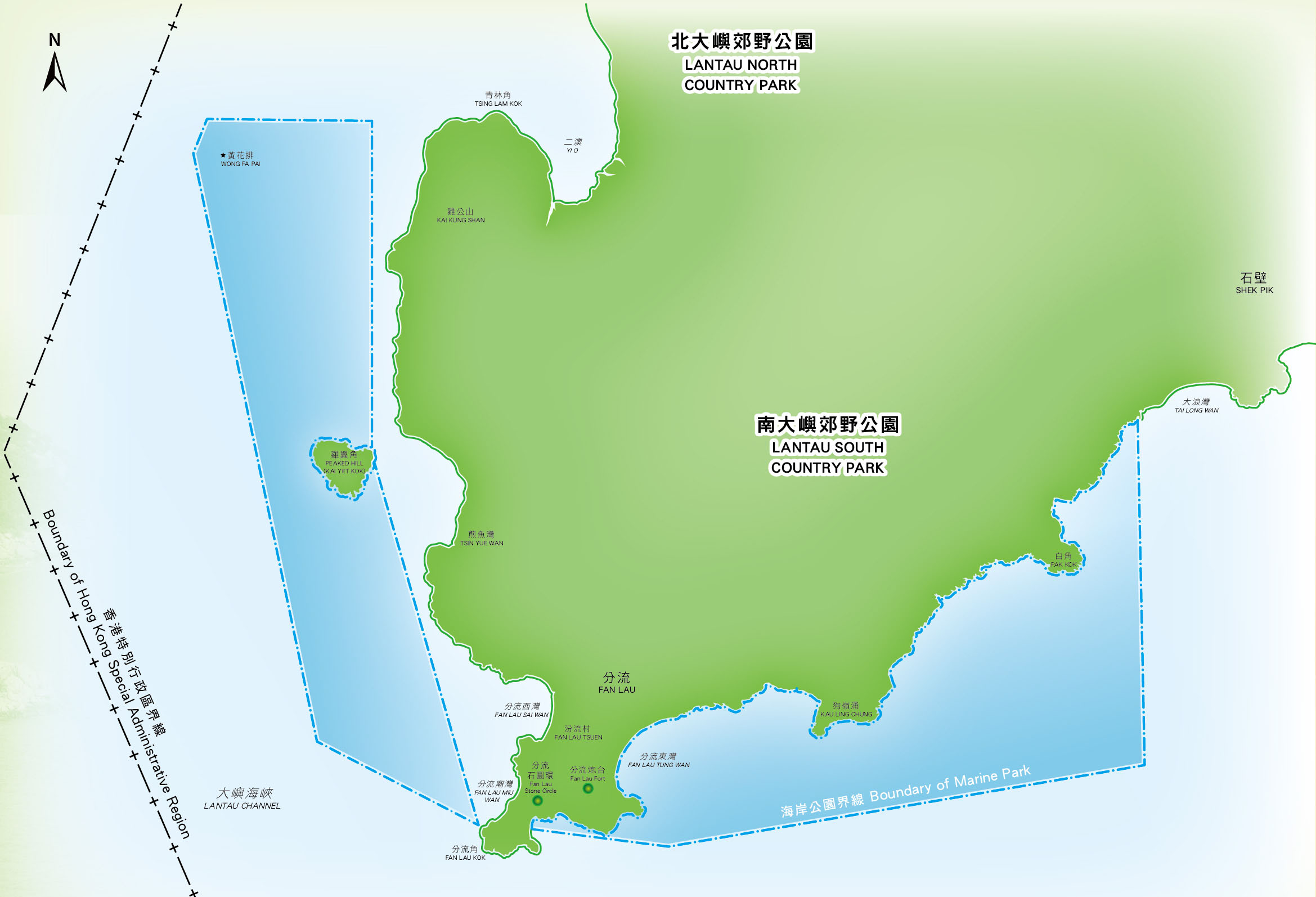
The Southwest Lantau Marine Park is situated in the southwestern coastal waters adjacent to the Lantau South Country Park on Lantau Island. The total sea area of this Marine Park is about 650 hectares and it is made up of two portions:
- The first portion refers to the nearshore waters along the coastline east of Fan Lau Tsuen, stretching from Fan Lau Tung Wan from the west to that of Pak Kok in the east;
- The second portion includes the nearshore waters west of Fan Lau Tsuen. Its boundary stretches from Fan Lau Kok in the south passing Peaked Hill (Kai Yet Kok) to the waters near Tsing Lam Kok in the north.
The Southwest Lantau Marine Park is designated in April 2020, with the aim to help better conserve Chinese White Dolphins (Sousa chinensis) in Hong Kong, their habitats and the fisheries resources within the area. The seaward boundary is generally demarcated by yellow lighted buoys and boundary posts. The landward boundary generally follows the high water mark along the coastline of Peaked Hill and Southwest Lantau. Please refer to the gazette map and explanatory statement for the actual boundary.
Map of Southwest Lantau Marine Park
 |
|
(press to download (The map is for general reference only. |
Ecology of the Southwest Lantau Marine Park
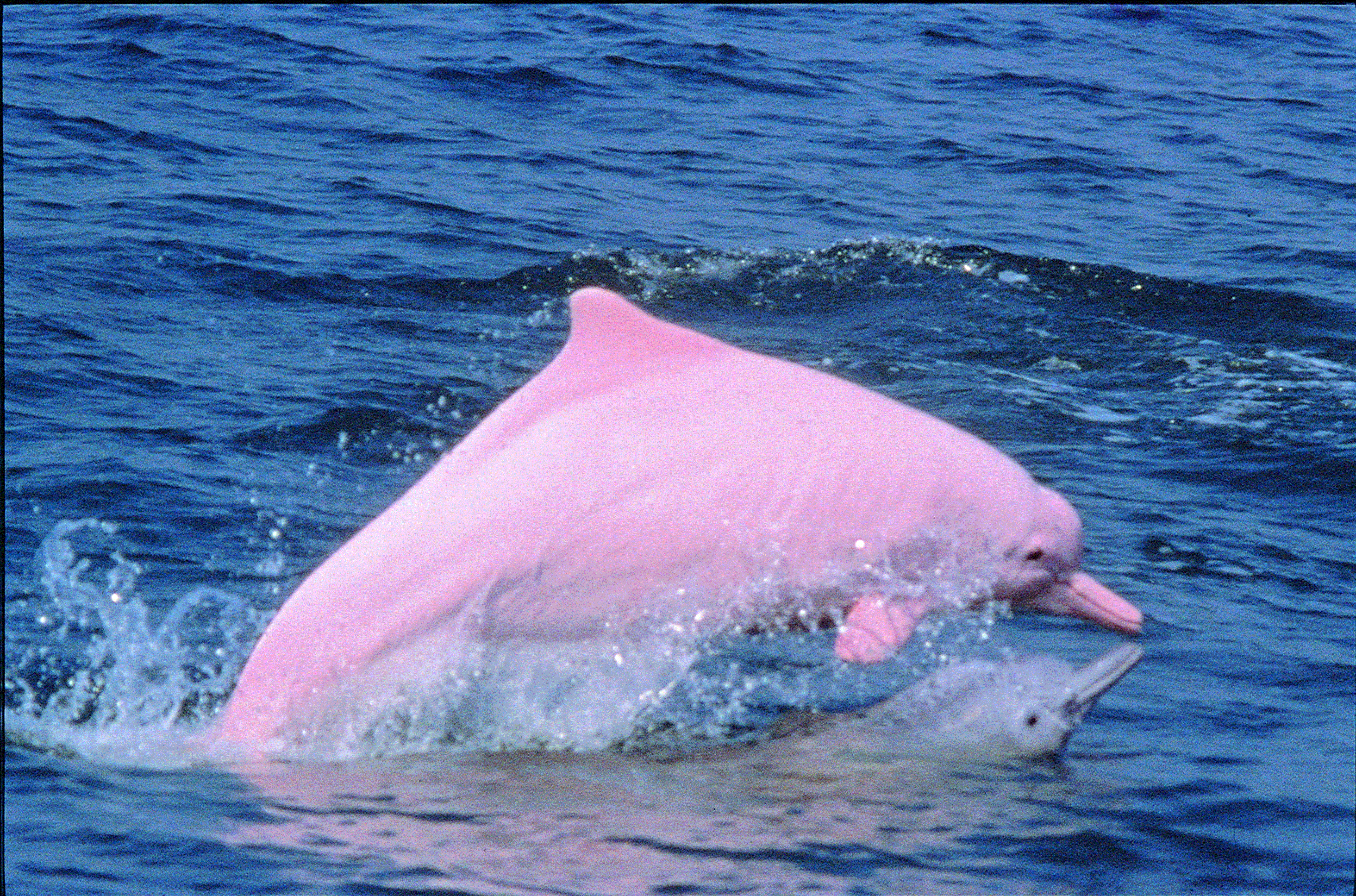
Due to the unique marine environment of the Southwest Lantau Marine Park which is relatively influenced by the Pearl River freshwater runoff, with relatively higher organic loading and suspended sediments. It serves as an important habitat for Chinese White Dolphins (Sousa chinensis).
Coastal waters of the Southwest Lantau Marine Park, stretching from Kai Kung Shan, Peaked Hill to Fan Lau, is one of the areas with the highest density of Chinese White Dolphins in Hong Kong where consistent and frequent occurrence of dolphins have been recorded in all seasons. Moreover, with abundant fisheries resources in the area, the waters of Southwest Lantau Marine Park serves as a feeding ground of Chinese White Dolphins.
For more details on the ecology of this area, please visit Ecology in Marine Parks.
Declared Monument
Fan Lau Fort on Lantau Island
Fan Lau Fort, located on the strategic south-western tip of Lantau, was proposed in 1717. It served to guard the channel leading to the Pearl River estuary and Guangzhou. It formed part of the Qing Government's coastal defence system which was set up to suppress roaming pirates and to control the increasing trade with the West. Fan Lau Fort can be a citation of the importance of Hong Kong in maritime defence in the past. It was probably abandoned around 1898 after the lease of the New Territories to Britain. It was declared as a monument in 1981 and is protected under the Antiquities and Monument Ordinance.
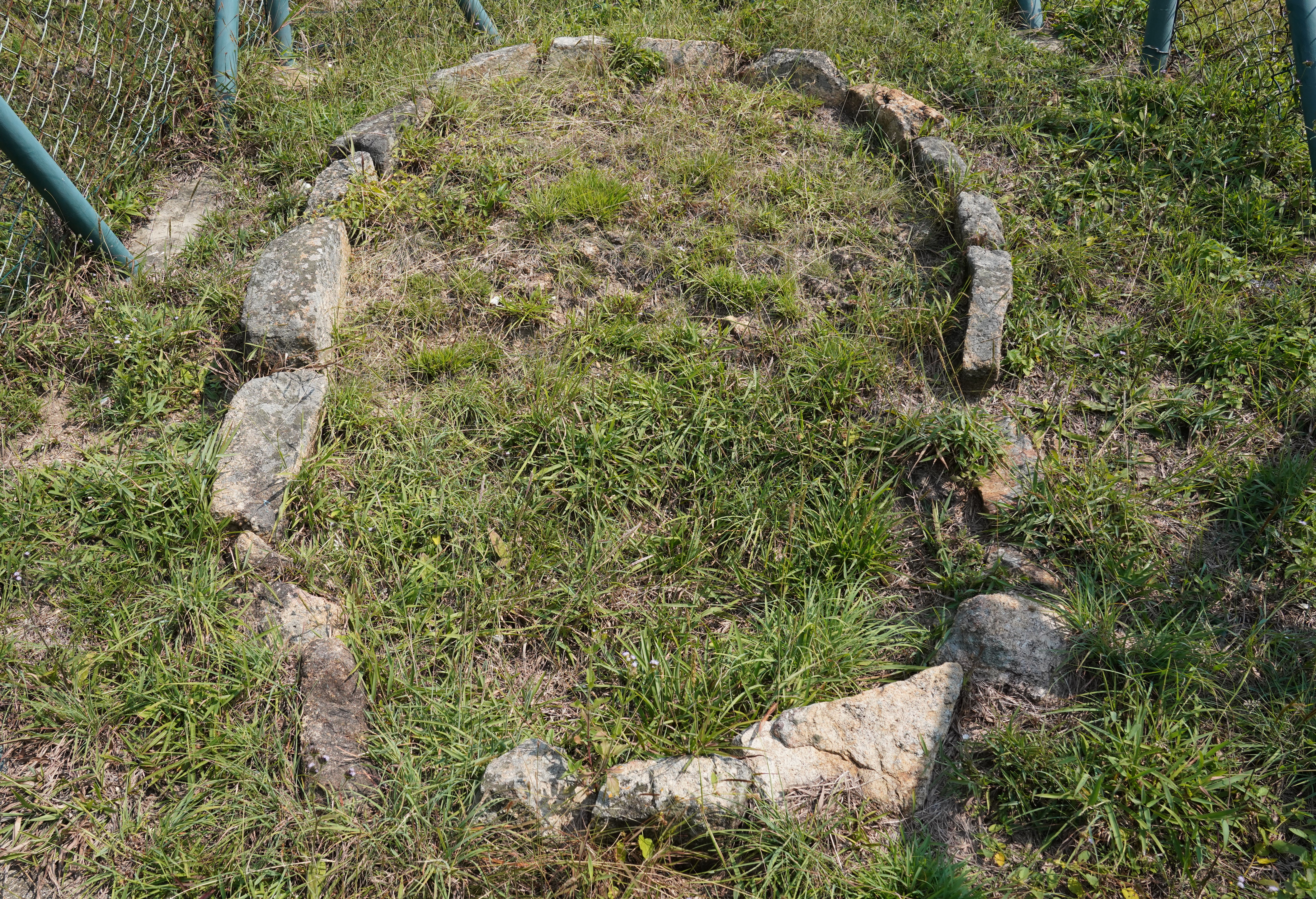
Fan Lau Stone Circle
The circular arrangement of the unhewn stones appears to be laid out deliberately forming an oval-shaped enclosure, measuring 2.7m by 1.7m. It is believed to be a megalithic structure made during the late Neolithic (i.e. New Stone Age) and early Bronze Age. The purpose of the stone circles are not known but historians believe that the structures were used for ritualistic activities. It was declared as a monument in 1983 and is protected under the Antiquities and Monument Ordinance.