Shing Mun
Overview
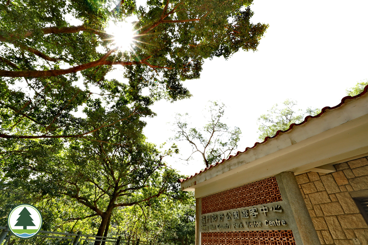
Shing Mun Country Park commands a site of 1,400 hectares. From its northern edge in Lead Mine Pass, it extends to Shing Mun Road in the south. The western border lies in Tai Mo Shan, while Grassy Hill and Needle Hill mark the eastern margin. This idyllic sanctuary is nestled deep in the southeastern hills of Tai Mo Shan. Shielded by peaks and ridges on all sides, it is bestowed with lyrical scenery. For decades, it has been one of the best loved leisure destinations in Hong Kong. Funded by the Sir David Trench Fund for Recreation, the Government introduced a pilot programme for countryside recreation facilities in 1971. Designated in 1977, Shing Mun Country Park was one of the first country parks in the territory. Other country parks dated back to the same era are Kam Shan Country Park and Lion Rock Country Park. In 1923, responding to urban Kowloon's pressing need for water supply, work began for the Shing Mun Reservoir. To make way for this monumental project, original villagers of the Shing Mun Valley were relocated to the New Territories. This impressive facility was eventually completed in 1937. Sitting by the minibus terminus, the Shing Mun Country Park Visitor Centre offers interesting exhibits that present country parks’ history, war relics, as well as the hiking trails, attractions and biodiversity in Shing Mun Country Park. Inside the country park, the Shing Mun Arboretum with rich plant resources is a wonderful place to appreciate Hong Kong's flora.
Major Attractions
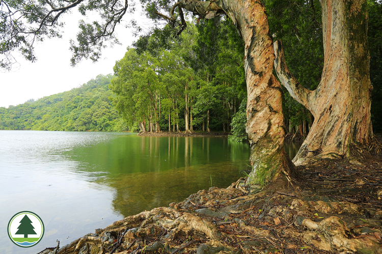
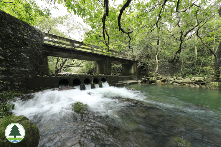
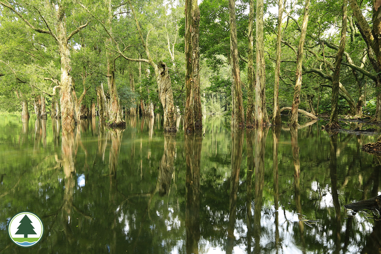
Shing Mun Reservoir is the largest water storage facility at the foot of Tai Mo Shan, and the most unforgettable sight of Shing Mun Country Park. Measuring 2 km in length, the reservoir is orbited by a winding lakeside path that stretches for many kilometres in the verdant valley. This unspoiled piece of country park has many hidden corners for explorers. The most relaxing way to experience its natural beauty is to stroll along the east bank of the reservoir. The trail starts at the northern end of the main dam. Meandering along the embankment, it takes you deep into the beautiful Shing Mun woodlands. In summer, Common Melastomas (Melastoma candidum) dress the slopes a bubbly pink, against chartreuse ravines overlaid with Galingales. In the low wetlands, profuse trees and shrubs enclose the water. Continuing up the hills, the trail passes some large streams before making a descent through dense forests developed from overgrowing fung shui woods in the relics of old Shing Mun villages. To the northwest of Shing Mun Reservoir, you find Tai Shing Stream, a waterway that runs from the uplands of Tai Mo Shan to the reservoir. The name Tai Shing Stream was given by hikers, and reflects the stream's highland origin and lowland end. Voted one of the nine greatest streams of Hong Kong, it is a broad waterway with an exuberant flow. It is also a major rock stream that feeds the Shing Mun Reservoir. Shing Mun Country Park is primarily granite and volcanic rock terrain. The uplands are mostly volcanic rock, while the southern lowlands are formed by granite which is more vulnerable to erosion. The eastern region of the park boasts rich reserves of tungsten, and mining began here in as early as 1936. After a brief interruption during WWII, ore production resumed soon after the war. In the heyday, the Shing Mun mines had an average monthly output of 30 tonnes, all of which was exported overseas. In 1968, tungsten prices began to plummet, and the mines gradually went into disuse. Today, you can still find abandoned mine pits around Lead Mine Pass. Some of them date back a few hundred years. Facilities
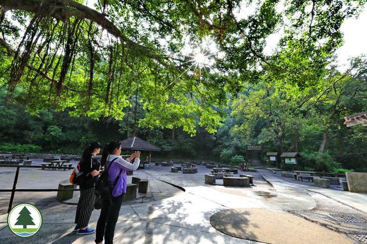
To familiarise yourself with the Shing Mun area, check out the information board and direction signs at the entrance of the country park. Barbecue areas can be found in the south and southeast near the dam. Other facilities are toilets, kiosk, rain shelter, jogging trail, the Pineapple Dam Nature Trail and a lookout. For campers, there is a campsite near Lead Mine Pass. Hiking for about an hour from the Shing Mun Country Park Visitor Centre, you arrive at Hong Kong's one and only live arboretum. The 4-heactare Shing Mun Arboretum is converted from abandoned rice terraces. Since the 1970's, many representative flora species have been planted here. Now it has collected about 300 species native to Hong Kong or Southern China.. Among them are many rare and endangered species. Indeed, the arboretum plays a vital role in flora conservation. Shing Mun Arboretum is home to many interesting trees and plants. These include many bamboo species, protected plants, plants named after renowned botanists, plants first recorded in Hong Kong and wild camellias native to Hong Kong. A visit to the arboretum is more educating than reading a botanical field guide.
Ecological Highlights
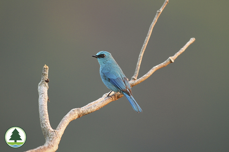
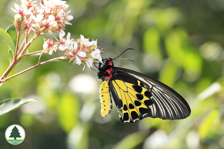
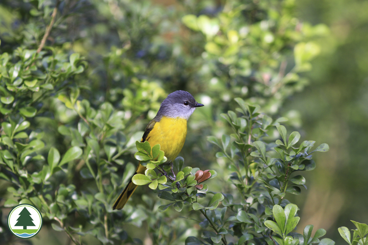
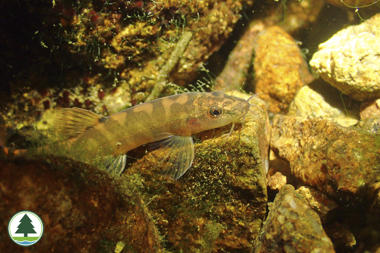
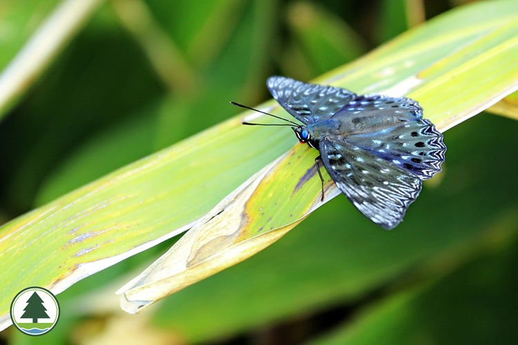
Shing Mun Country Park is famous for its profuse woodlands. In front of the reservoir one finds the original site of the old Tai Wai village. Nearby is a fung shui woodland harbouring magnificent old trees belonging to more than 70 species. To preserve the local flora, this site has been designated a Special Area protected by law. Along Tai Shing Stream to the west of Shing Mun Reservoir, there is a dazzling show of flowering plants. Several species of camellia grow here, including the rare Grantham's Camellia (Camellia granthamiana) that flaunts striking white flowers measuring over 12 cm in diameter. First recorded in Hong Kong several decades ago, this camellia is named after Sir Grantham, former Governor of Hong Kong. The Japanese Occupation during WWII took its toll on Shing Mun. Most of the slopes were denuded. Soon after the war, reforestation went underway. In the early years, Chinese Red Pine (Pinus massoniana) was a key plantation species. Subsequently other trees like Slash Pine (Pinus elliottii), Brisbane Box (Lophostemon confertus), Paper-bark Tree (Melaleuca quinquenervia) and Taiwan Acacia (Acacia confusa) were introduced to add variety. Today, Shing Mun is one of the most important plantations of Hong Kong. Given its close proximity with the built-up urban district of Tsuen Wan, Shing Mun Country Park is home to relatively common birds and mammals, such as Chestnut Bulbul (Hemixos castanonotus), Greater Necklaced Laughingthrush (Pterorhinus pectoralis), Pallas's Squirrel (Callosciurus erythraeus), Red Muntjac (Muntiacus vaginalis), Rhesus Macaque (Macaca mulatta), Long-tailed Macaque (M. fascicularis) and their hybrid.
Scenic Beauty
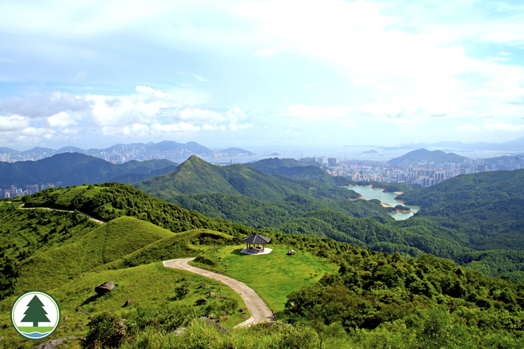
The richest woodlands can be found in Shing Mun Valley at the northern end of the reservoir facing Lead Mine Pass. Arguably the best plantations in Hong Kong, these forests make up a secluded Eden that every city dweller dreams about. Old stone walls, remnants of the past, are carpeted with moss, while terraces stand half-hidden on overgrown slopes. The fung shui woods cultivated by villagers are now a cradle for regenerated native afforestation species. Across the slopes, maturing subtropical forests spread in all directions. In the lush woodlands, you find towering trees as well as entwining vines that occupy the middle storey. Section 7 of the Wilson Trail leads from the Shing Mun main dam to Yuen Tun Ha. If you are looking for an unchallenging scenic route, this is not a bad choice. The uplands lure you with an alternative brand of natural beauty. Section 7 of the MacLehose Trail starts at the north end of the main dam. A seemingly endless flight of steps lead to Needle Hill. The going is tough but not without reward. At the 532 m summit, the grand landscape of Northwestern New Territories unfolds. Gazing down, you will see the nearby countryside and Shing Mun Reservoir delightful with soothing shades of green, while the symmetric profile of Lead Mine pass marks a striking presence in the north. After some steps, the trail soon joins a vehicular road to travel uphill for Grassy Hill, a formidable summit rearing up some 647 metres. Grassy hill is a watershed that divides Shing Mun Valley and Shatin Valley. Its steep slopes are the upland sources of the Shing Mun catchment and streams that run through the Tai Po Kau plantation. The vistas at the top are simply mesmerising. Beyond Shatin, the colossal Ma On Shan range squats firmly on the lowlands. In the background, the grand Sai Kung Peninsula beckons.
|