Designated Marine Parks and Marine Reserve
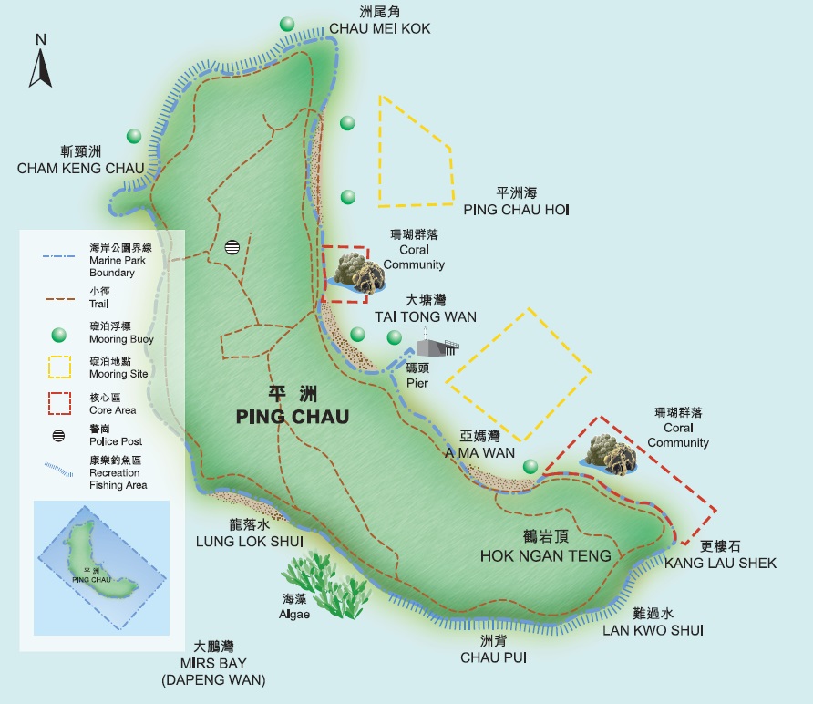
Tung Ping Chau Marine Park Tung Ping Chau Marine Park is the fourth Marine Park in Hong Kong. It was designated in November 2001. The marine park occupies a sea area of about 270 hectares which encloses the small island Ping Chau in the Mirs Bay on the northeastern water of Hong Kong. The landward boundary generally follows the high water mark along the coastline. Please refer to the gazette map and explanatory material for the actual boundary.
Map of Tung Ping Chau Marine Park
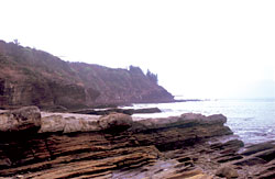
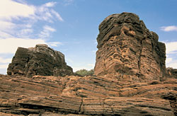
Tung Ping Chau, like Hoi Ha Wan, has a healthy and rich coastal ecosystem in Hong Kong. The coverage and species diversity of coral communities in Tung Ping Chau Marine Park is one of the best in Hong Kong. Other marine lives like algae, marine invertebrates and fishes are also found in the water of Tung Ping Chau Marine Park. For more details on the ecology of this area, please visit the Ecology of Tung Ping Chau Marine Park. Scenic Spots The unique and renowned geological features provide many good scenic spots for sightseeing on Tung Ping Chau. Kang Lau Shek Two unique sea stacks of about 7-8 m sit on the wavecut platform located on the southeastern tip of the island. The shape of the rocks is formed by the long-term wave and weather erosion. Many joints can be found on both vertical stacks. Lan Kwo Shui It is located on the southern coast of Tung Ping Chau with a long vertical cliff along the coast. As a result of long term wave actions, many caves are formed along the cliff. Only at low tide and in extra calm sea condition, Lan Kwo Shui can be reached by foot from Kan Lau Shek. Lung Lok Shui It is located in the outer coast of Tung Ping Chau and faces the southwest. It is a bed of long thick rock with triangular edge resembles a dragon's back extending into the sea. That is why it is so-called Lung Lok Shui. The formation of rock in peculiar shape is the result of various resistance of different rock layers to erosion. |
||||
|
||||
 ) (157 KB)